Bike Needs Repair – Bring your Bike to Ash Wednesday park A new facility is now available at Ash Wednesday Park for all cyclists. The recently completed Bicycle Repair Station was officially opened on Saturday 14th December 2024. See below for details and prize.
| Macedon Ranges has Hanging Rock, Anti-Gravity Hill, Ash Wednesday Park, Camels Hump, Centennial Park, Duneira, Kurana Memorial, Macedon Regional Park, Major Mitchell Lookout, Memorial Cross, Sanatorium Lake, Stanley Park, Trigonometry Cairn and more. | [qr-code id="1947"] |
Craft Markets Australia – Hanging Rock – 15th March 2025
Set at the scenic Hanging Rock Reserve, this makers market is well worth a day trip. Pack up the family or a group of friends and arrive early to see the resident Kangaroos watching the market come to life. Stroll around the stalls, meeting the makers behind the products Read More…
Ash Wednesday Park – Flying Fox
The Community are all welcome participate and share the Flying Fox at Ash Wednesday Park. (see below for details) The Flying Fox was made possible by the generosity of the Gisborne & District Community Bank Branch of the Bendigo Bank and funding grant for the Flying Fox Project. Need more Information contact us at webmail@mountmacedon.org.au Read More…
Duneira Estate Mount Macedon Autumn Season
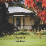
Duneira’s spectacular heritage listed garden will be opening during Autumn. Come for a visit and stroll and experience the spectacular colour and splendour of Mount Macedon at Duneira Please check the Duneira website for any changes. For more details: Follow Duneira on Facebook Instagram Duneira Estate Visit our website duneiraestate.com.au Phone 54 261490 Officer Read More…
Macedon Reservoir + The Res | Map: B6
Lake adjoining Nursery Rd and Middle Gully Rd Macedon Enjoy swimming and bushwalking around ‘The Res’ with close access to the Woodend to Macedon Shared Trail. Numerous walking tracks and picnic grounds are provided. Macedon Reservoir (lake) is commonly known as ‘The Res’ locally and a favourite swimming spot. A former steam engine supply reservoir, Read More…
Hanging Rock
Hanging Rock in the heart of the Macedon Ranges – less than an hour’s drive from Melbourne. Made famous in Joan Lindsay’s novel, Picnic at Hanging Rock, and Peter Weir’s film of the same title, ‘The Rock’ is home to numerous events throughout the year and is an icon for visitors and locals alike. Hanging Read More…
Honour Avenue, Macedon
Regarded as the world’s most scenic road in Autumn, Honour Avenue, Macedon is visited by thousands every year. Honour Avenue, Macedon has 154 Pin Oaks creating an arch of leaves from late March to late April each year. Centennial Park located at the end of Honour Avenue, is a popular spot for picnics. Described as an Read More…
Annis and George Bills Horse Trough | Map: C7
The Macedon Horse Trough and hitching rail is located opposite the hotel next to the public amenities. The horse trough reinstates the horse trough damaged in the 1983 bushfires. These horse troughs were placed throughout Australia to provide water for the many animals that travelled long journeys throughout the vast countryside. Donated in memory of Read More…
Hanging Rock Winery
Hanging Rock Winery was established in 1983 by the Ellis family and has grown to be the largest winery in the region. The cellar door has a splendid vista overlooking Hanging Rock and offers over 20 wines covering most styles and varieties along with estate grown Hanging Rock Beef. P: 03 5427 0542 E: hrw@hangingrock.com.au Read More…
Things To Do | Macedon & Mount Macedon District
There are so many interesting and fun things to do in THE MACEDON & MOUNT MACEDON DISTRICT View the spectacular Autumn colours of Honour Avenue and the surrounding district during the Autumn season throughout the area. Enjoy walking, running, cycling or horseback riding on the many trails throughout the Macedon Regional Park or linking local Read More…
Anti-Gravity Hill
Anti-Gravity Hill in Woodend is one of our best kept secrets and most unusual and baffling places,. Standing near the bottom of a hill facing up hill, if you tip water onto the road it flows ‘up’ the hill not downhill as gravity would normally do. Place a ball on the road and the same thing Read More…
Ash Wednesday Park | Map:C7
Ash Wednesday Park is a leafy picturesque park located in Smith Street that provides playground and BBQ facilities for visitors and locals. Ash Wednesday Park commemorates the bushfires that took place in 1983. The area was devastated by the Ash Wednesday fires of 1983. Located in the centre of Macedon in a natural bush setting, Read More…
Camels Hump | Map: D4
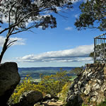
The Camels Hump is the highest point in the Macedon Ranges, with a lookout offering visitors spectacular views. This is one of three local rocky outcrops formed by volcanic action millions of years ago. The Camels Hump is located near the start of Cameron Drive. Several walking tracks depart from the Camels Hump car park, Read More…
Centennial Park | Map: D7
Centennial Park is located on Mount Macedon Road at the intersection with Honour Avenue and is the Southern Gateway to Macedon and Mt. Macedon. The Information bay and Touring Map is a focal point for information to the area. The park consists of large grassed recreational areas which showcase the Memorial, Stone Sculptures and Mosaic Read More…
Kurana Memorial | Map: C5
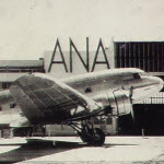
Kurana Memorial is situated in the Cross Reserve to commemorate the DC3 “Kurana” aircraft disaster in 1948. The Kurana Memorial recognises the 50th anniversary of the incident. 8th November 1948 The Kurana: The DC-3, VH-UZK Kurana took off from Essendon Airport on its way to Deniliquin. Flying at 3,000ft in misty conditions and light rain, passengers Read More…
Macedon Regional Park | Map: C5
The Macedon Ranges form the southern end of Victoria’s Great Dividing Range and feature a diverse range of natural and cultural features. The 2,379 hectare park protects forested land along the ridge of the Range and offers great opportunities for bushwalking, scenic drives and picnics. A large area on the summit of Mount Macedon has been set Read More…
Major Mitchell Lookout | Map: C5
The plaque erected at Major Mitchell Lookout commemorates the naming on 30th December 1836 of Mount Macedon by Major Thomas Mitchell, Surveyor General of the Colony of NSW. Major Thomas Mitchell, Surveyor General of the Colony of New South Wales; was the first person to map and survey Mount Macedon, naming the Mountain after Philip Read More…
Mount Macedon Memorial Cross
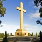
With glorious views, the Cross commemorates those who gave their lives in the 1914 – 1918 war. The Cross is 21m in height and 1001m above sea level, the original structure was unveiled in 1935, but due to storm and fire damage, it was replaced in 1995. At the summit of Mount Macedon is the Read More…
Sanatorium Lake | Map: E4
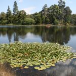
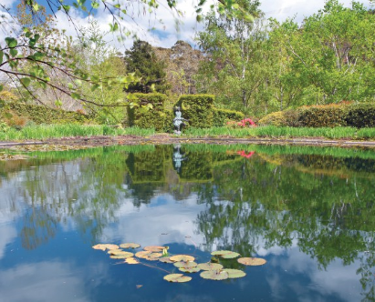
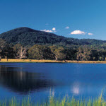
This man-made lake, famous for its intense reflections, was built to provide a water supply for a proposed Sanatorium for tuberculosis patients. The lake remains as a tranquil place and as a reminder of advances made in medical science over the years. Sanatorium Lake is accessed via Lions Head Road which is almost opposite the Read More…
Stanley Park | Map: C6
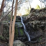
Situated in Salisbury Road where Turitable Creek cascades over an ancient lava flow. A large reserve in a natural bush setting, and one of the most popular destinations in the region with locals and visitors alike. Barbecue facilities, tennis courts, playground equipment and pleasant walking tracks where koalas may sometimes be seen. Play equipment caters Read More…
Mount Macedon Historic Survey Cairn | Map: C5
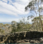
Erected in 1853, the Trigonometry Cairn is located on the exit road from Cross Reserve. From this point, all surveys in this district originated. A cairn is a human-made pile (or stack) of stones used as a marker. All surveys carried out in the Macedon Ranges originated from this point. The Cairn is the second oldest Read More…


